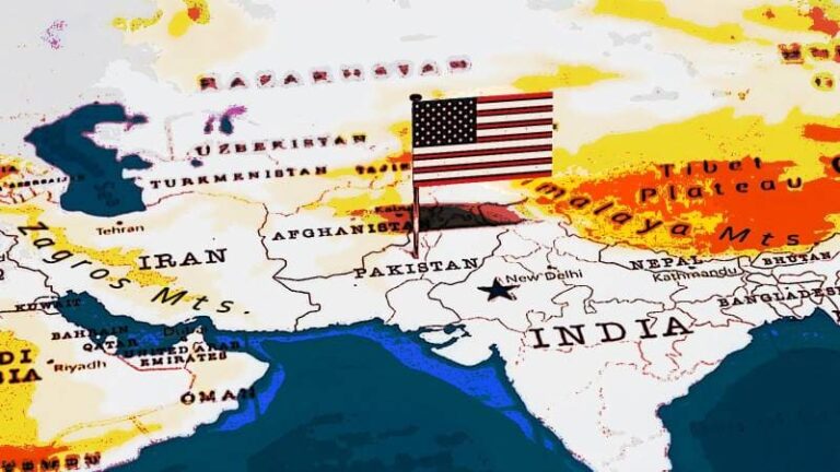
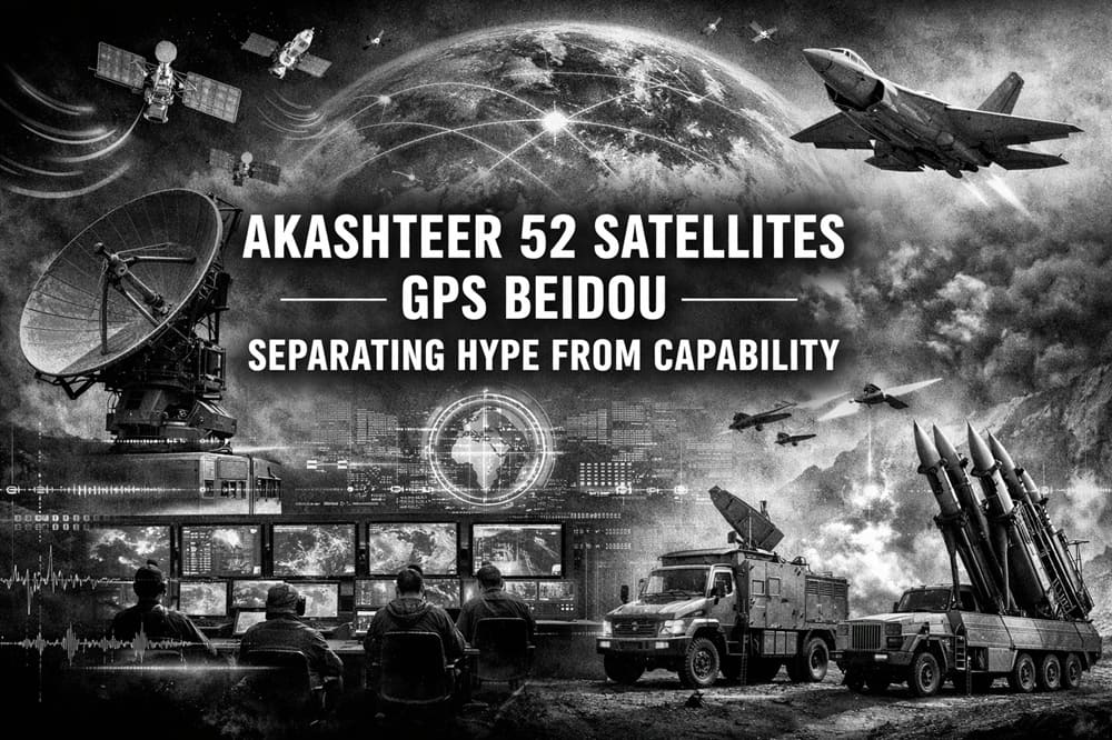
Indian Akashteer 52 Satellites — Separating Hype From Capability
One trick that viral defense graphics often employ is blending real program names with dramatic effects, followed by the addition of a large round number. The latest version claims India fused Akashteer with 52 “AI spy satellites” to “block GPS and China’s BeiDou.” It sounds coherent, and it feels modern. However, the underlying pieces sit in different lanes: air-defense command-and-control, space-based surveillance, and electronic warfare. This issue arises because professionals model capability based on architecture, not slogans. Therefore, you should treat the Akashteer 52 satellite’s GPS BeiDou narrative as a prompt to map what each layer does, how data flows, and where the kill chain can realistically break.
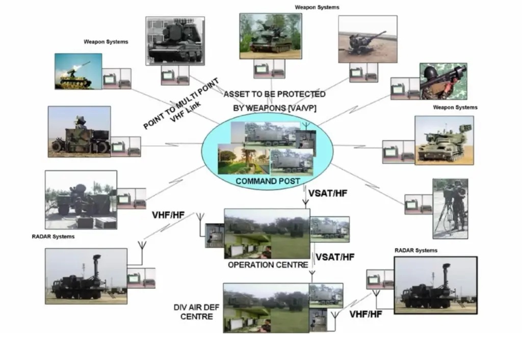
Akashteer’s Core Role
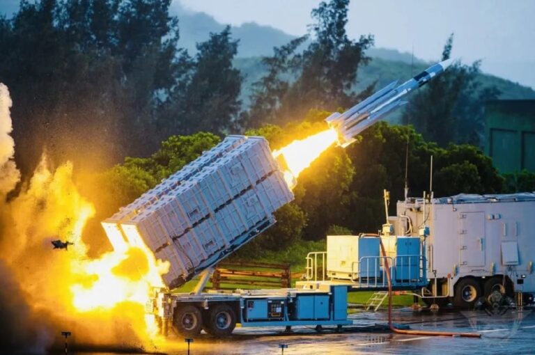
Akashteer is best described as an automated air-defense control and reporting system for the Indian Army’s air-defense ecosystem. In simple terms, it helps operators build a shared air picture, distribute tracks, and cue engagements faster. Moreover, it facilitates deconfliction, ensuring friendly aircraft avoid entanglement in densely crowded airspace. Crucially, this task involves command and control. Akashteer sits where radars, communications nodes, and weapon units must “talk” in a structured way. That design focus makes Akashteer relevant to drones, cruise missiles, and low-level threats. Yet it does not automatically make Akashteer an anti-satellite or global navigation “off switch.”
Origin of the “52 Satellites” Figure
The “52” figure has a real anchor in open reporting about India’s push for space-based surveillance. Business reporting has described SBS-3 (Space-Based Surveillance Phase-III) as a program intended to deploy 52 defense-related satellites by 2029, with a reported cost of ₹26,968 crore. That constellation logic is straightforward. More satellites usually mean better revisit rates, more persistent coverage, and less time between “last seen” and “now.” Consequently, analysts expect better maritime domain awareness, improved border surveillance, and quicker cueing for downstream forces. But surveillance satellites do not, by default, “block” satellite navigation signals. Therefore, the Akashteer 52 satellites’ GPS BeiDou line should be interpreted as a cohesive narrative rather than a singular integrated weapon.
“AI-Powered” Usually Means Automation
The graphic leans heavily on “AI.” In defense marketing, that term often signals three practical features:
- The graphic emphasizes the automated correlation of data from multiple sensors to support decision-making and reduce operator workload.
- Decision-support to reduce operator workload
- Faster dissemination of a consistent air picture
In other words, AI language often points to workflow acceleration and pattern recognition. It does not guarantee fully autonomous targeting, and it does not replace physics or spectrum constraints. Therefore, the right question is not “is it AI?”, but “does it reduce cycle time and operator error under pressure?”
Can This Stack Disrupt GPS and BeiDou?
To evaluate that, you have to split the problem into space and local battlespace.
1) How GNSS Disruption Works
“Blocking” GNSS typically comes from jamming or spoofing, not from surveillance satellites.
- Jamming is intentional RF interference that prevents a receiver from locking to weak satellite signals.
- Spoofing transmits counterfeit GNSS-like signals to deceive receivers into calculating false positions or times.
Both effects are usually local or regional, tied to ground-based or airborne emitters, antenna gain, and terrain. Moreover, they can cause collateral impact on civilian receivers if used near busy air routes or commercial shipping lanes. If someone claims that the Akashteer 52 satellites’ GPS BeiDou system “blocks” navigation, you should inquire about the location of the jammers, their power levels, the area they cover, and how the system prevents self-harm.
2) What Satellites Actually Add
Satellites can help in two ways:
- They can improve situational awareness by spotting activity, changes, and movement patterns.
- They can support cueing, so ground sensors point at the right sector earlier.
That support strengthens the sensor-to-shooter chain. However, it does not create a direct GNSS-denial effect by itself. Therefore, the credible story is “better detection and faster tasking,” not “space-based GPS shutdown.”
The Integration Model to Watch
A more defensible framework looks like this:
- Space-based surveillance increases revisit and early warning for areas of interest.
- Ground radars refine tracks, classify targets, and maintain continuity at low altitude.
- C2 networks like Akashteer distribute the air picture to lower echelons quickly.
- Electronic warfare units contest datalinks and GNSS locally where needed.
- Shooters execute engagements using a tighter loop and cleaner deconfliction.
That chain explains why states invest in both C2 and satellites. It also shows why viral posters oversell outcomes. They compress multiple systems into one headline because it spreads well.
References
- https://www.pib.gov.in/PressReleasePage.aspx?PRID=2129132
- https://bel-india.in/product/air-defence-control-and-reporting-system-adcrs/
- https://www.business-standard.com/external-affairs-defence-security/news/india-defence-satellites-sbs3-surveillance-isro-china-pakistan-iok-125063000690_1.html
- https://skybrary.aero/articles/gnss-jamming-and-spoofing